Northern Route
Being the longest route on Kilimanjaro,the Northern Circuit offers simple time for acclimatization, resulting in the highest summit success rate among all routes. This makes it a top recommendation for trekkers aiming to reach Uhuru Peak with comfort and confidence.
The adventure begins in Moshi with a drive to Londorossi Gate, where the western approach to the mountain starts. Trekkers spend the first two days hiking through lush rainforests to reach Shira Ridge, and then cross the vast Shira Plateau. From there, the path veers north, looping clockwise through Moir Hut, Buffalo Camp and School Hut, before the final summit push from the eastern side. The descent follows the Mweka Route, leading back through the forest.
Kilitrips offers several variations of the Northern Circuit Route:
This is the most popular version, offering a balanced pace with optimal acclimatization and scenic diversity.
This variation follows the standard 9-day route but changes the summit strategy. Instead of starting the final ascent at midnight, trekkers begin during daylight hours, avoiding the extreme cold and wind. The descent includes an overnight at Barafu Camp instead of Mweka Camp, extending the journey by one day for a more relaxed experience.
Ideal for those with limited time, this option combines days three and four of the standard itinerary. Trekkers head straight to Moir Hut, bypassing the Lava Tower acclimatization hike.
This follows the 8-Day route with the same daytime summit variation, offering a daytime ascent and an overnight at Barafu Camp instead of descending directly to Mweka Camp.
A special private climb variation that includes a rare overnight stay at Crater Camp, located just beneath the summit. This unique experience allows trekkers to rest close to the peak before the final short ascent to Uhuru Point.
What is the length of the Northern Circuit Route?
The Northern Circuit route covers an approximate distance of 88 km ( 53 miles), making it the longest route to the summit of Mount Kilimanjaro.
What is the duration to climb Kilimanjaro on the Northern Circuit Route?
The duration of the Northern Circuit trek varies depending on the chosen itinerary. Climbers typically complete the journey in 8 to 10 days.
6 Day Umbwe Itinerary
Elevation: 5,249 ft to 9,514 ft
Hiking Time: 5-7 hours
Distance: 11 Km ( 7 miles))
Habitat: Heath
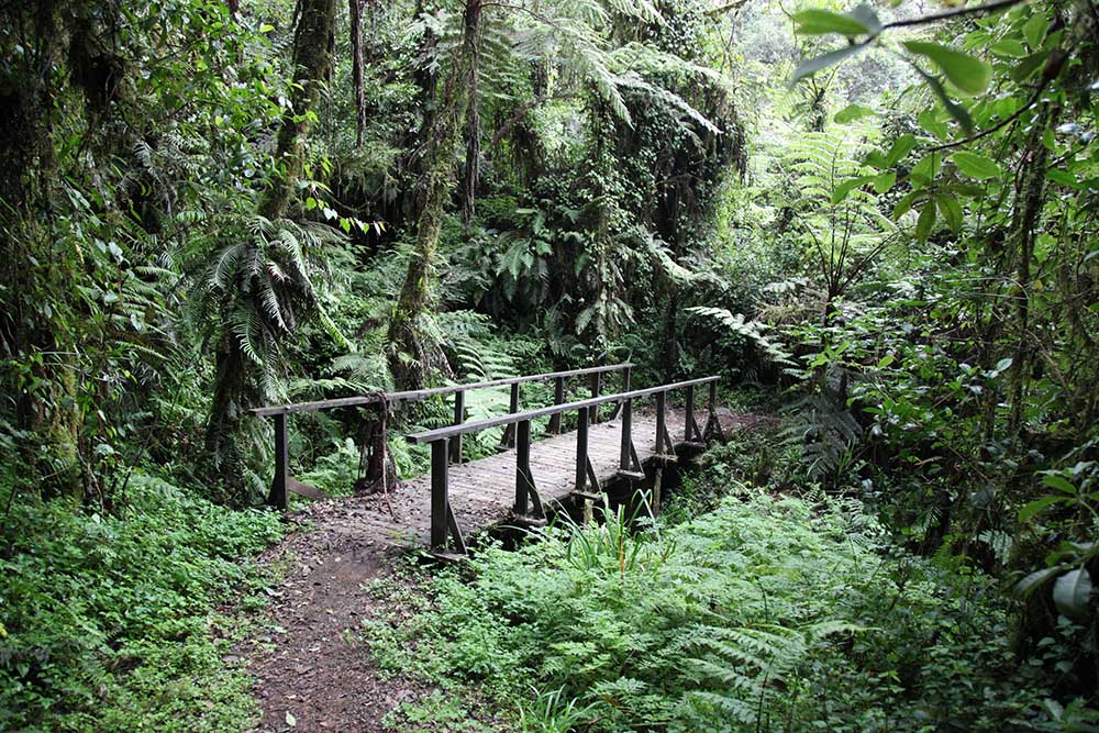
The day starts with a 50- minute drive to Umbwe Gate, where we complete the registration formalities. From there, we continue through charming villages and lush coffee and banana plantations to reach Umbwe Gate. The trail begins with a steep ascent along a forest track that winds through dense rainforest. As we climb higher, the path becomes narrower and steeper, following a ridge between two rivers and surrounded by towering trees. Our destination for the right, Umbwe Camp, is set amidst thick vegetation and tall forest trees.
Elevation: 9,514 ft to 13,044 ft
Hiking Time: 4-5 hours
Distance: -6 Km ( 4 miles)
Habitat: Heath
On the second day, the trail leads through rocky terrain with sparse vegetation and moss-draped trees. As we climb higher, stunning glimpses of Mount Kilimanjaro begin to appear. The path gradually levels out toward Barranco Valley, before descending from the Umbwe ridge through the unique Senecio Forest to reach Barranco Camp
Elevation: 13,044 ft to 13,106 ftt
Hiking Time: 4-5 hours
Distance: 5 Km ( 3 miles)
Habitat: Alpine Desert
The day starts with a descent into a deep ravine at the base of the Great Barranco Wall. We then tackle the steep, yet non-technical,900- foot climb to the top of the wall. From there, the trail winds across a series of ridges and valleys before descending sharply into the Karanga Valley. A final, steep ascent brings us to Karanga Camp. This shorter trek day is designed to aid acclimatization.
Elevation:13,106 ft to 15,331 ft
Hiking Time: 4-5 hours
Distance:4 km ( 2 miles)
Habitat: Alpine Desert
We depart from Karanga and join the junction that connects to the Mweka Trail. The route then ascends through a rocky section leading to Barafu Hut. At this point, the Southern Circuit is complete, providing panoramic views of the summit from multiple perspectives. We set up camp here, rest and have early dinner in preparation for the upcoming summit attempt. From this vantage point, both Mawenzi and Kibo peaks are clearly visible.
Barafu Camp to Uhuru Peak
Elevation: 15,331 ft to 19,341 ft
Hiking Time: 6-8 hours
Distance: 5 Km ( 3 miles)
Habitat: Arctic
Uhuru Peak to Mweka Camp
Elevation: 19,341 ft to 10,065 ft
Hiking Time:4-6 hours
Distance:12 Km ( 7 miles)
Habitat: Rain Forest
In the very early hours of the morning, around midnight, we begin our final push to the summit. This is the most physically and mentally demanding part of the trek. The cold and wind at this altitude can be intense, making each step a true test of endurance. We ascend through the darkness for several hours, taking short, frequent breaks to maintain our pace. As we near Stella Point at 18,900 ft, we are greeted by a breathtaking sunrise over Mawenzi Peak- a view few will ever forget. From there, it is a final climb to Uhuru Peak, the highest point on Mount Kilimanjaro and the African continent.
After reaching the summit, we begin our descent, heading directly down to Mweka Camp. Along the way, we stop at Barafu Hut for lunch. The rocky trail can be tough on the knees, so trekking poles are highly recommended. Mweka Camp lies within the upper forest, where mist or rain is common in the late afternoon. In the evening, we savor our last dinner on the mountain before enjoying a well-earned night’s rest.
Elevation: 10,065 ft to 5,380 ft
Hiking Time:3-4 hours
Distance: 10 Km ( 6 miles)
Habitat: Rain Forest
On the final day, we begin our descent to Mweka Gate, where we will receive our summit certificates. The lower sections of trail can be wet and muddy. So caution is advised. At Mweka Village a vehicle will be waiting to transfer us back to our hotel in Moshi.